Register
This
interface implements methods to register a raster. Image
registration is establishment of correspondence between images of the
same scene. Many image processing applications like remote sensing for
change detection, estimation of wind speed and direction for weather
forecasting, fusion of medical images need image registration. Image
registration is a process of aligning two images acquired by
same/different sensors, at different times or from different
viewpoint.
To
register
images, we need to determine geometric transformation that aligns
images with respect to the reference image. The most common
transformations are:
The
parameters of the geometric transformation are calculated based on a
given set of tie-points.
The
tie-points can be obtained manually or automatically as follows:
- Manual method: This
is
the case where the algorithm will generate the registered image based
on manually selected tie-points,
- Automatic method: This
is the case where tie-points are automatically generated by other
algorithm comparing the input image with
another reference image. The generated tie-points are later used by the
register algorithm to generate the registered image.
It
is
accessible through:
Raster
Processing > Register...
This
wizard consists of the
following steps:
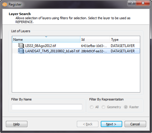
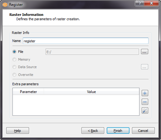
Wizard Page 1 - Selection
of the layer with the REFERENCE raster (Layer Search).
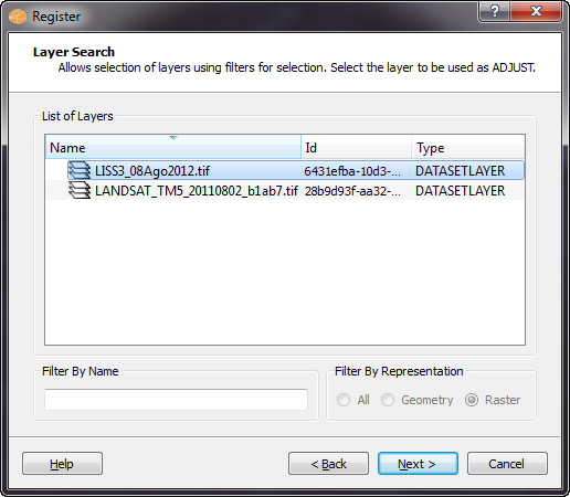
Wizard Page 2 - Selection
of the layer with the ADJUST raster (Layer Search).
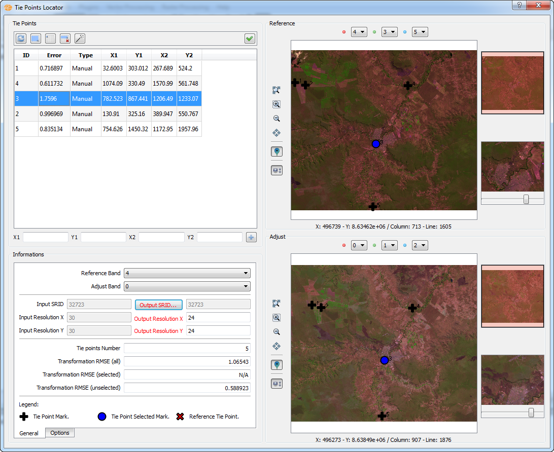
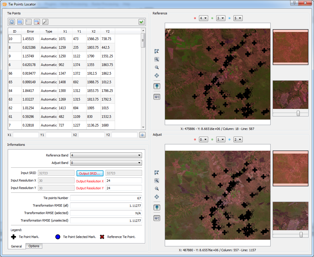
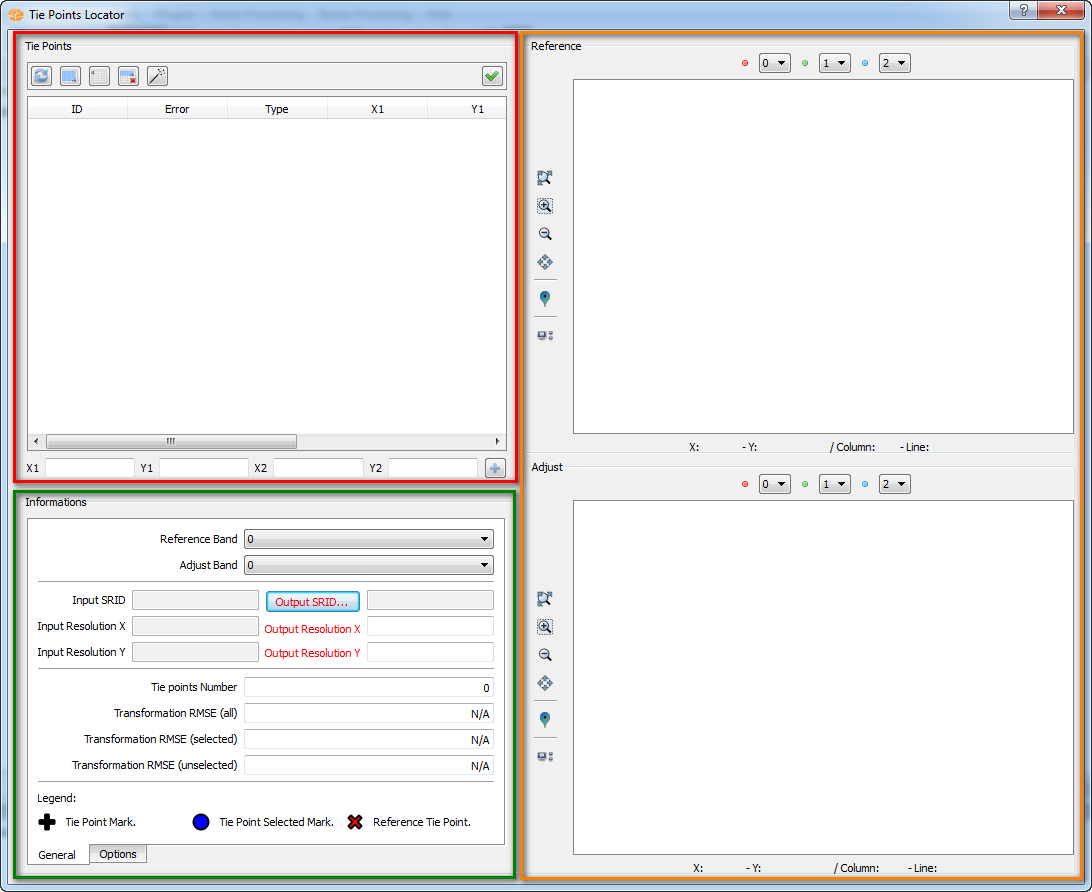
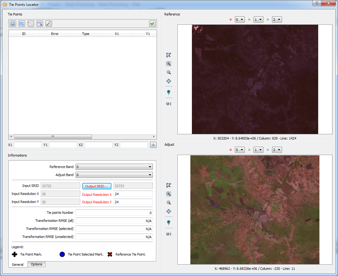
Wizard Page 3 - The register interface
The registration interface is
composed of three components:
- In the red box
shows
the tools to control
the tie points acquired. You can select and remove
specific items. It also has a tool (wand) for automatic acquisition of
the tie points.
- The first tool is a update
button, used when the geometric parameters are changed.
- The user is allowed to add
tie points from the definition of
each coordinated via keyboard. At the bottom of this
component
are four fields that allows the user to set the values for the
coordinates. The (+) button inserts the values to the list of
tie
points.
- In the green box
the
user can define the parameters used for the execution of this
operation. In the "Options" tab you can define
specific parameters for each type of geometric
transformation
available *.
- In the orange box
are
presented displays containing the reference and adjust images
so
that the user can make the acquisition of the tie points (Raster
Navigator).
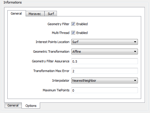
* In the "General" tab, the
following information is displayed:
- Reference Band: Band of
reference image to be used in register operation.
- Adjust Band: Band of
adjust image to be used in register operation.
- Input: Reference image metadata.
- SRID: Information about spatial reference
system from image.
- Resolution X: horizontal resolution of the image
pixels.
- Resolution Y: vertical resolution of the image pixels.
- Output: Adjust image metadata.
- SRID: Information about spatial reference
system from image.
- Resolution X: horizontal resolution of the image
pixels.
- Resolution Y: vertical resolution of the image pixels.
- Tie points number: Number
of acquired tie points.
- Transformation RMSE:
Calculates root mean square direct mapping error.
- All: For all tie points
acquired.
- Selected: For selected
tie points.
- Unselected: For
unselected tie points.
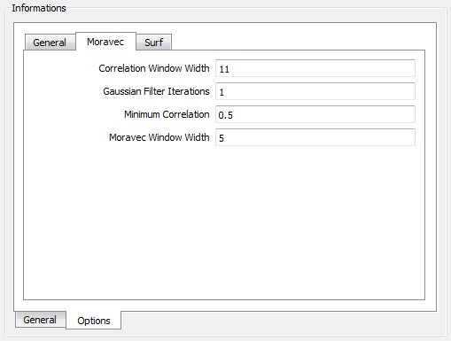
In the "Options" tab are
presented information about the geometric transformation:
Moravec
options:
- Correlation Window Width:
The correlation window width used to correlate points between the
images (minimum 3, default: 11).
- Gaussian Filter Iterations: The
number of noise Gaussian iterations, when applicable (used to remove
image noise, zero will disable the Gaussian Filter, default:1).
- Minimum Correlation: The
minimum acceptable absolute correlation value when matching features
(when applicable), default:0.5, valid range: [0,1].
- Moravec Window Width: The
Moravec window width used to locate candidate tie-points (minimum 3,
default: 5 ).
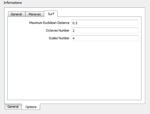
Surf
options:
- Maximum Euclidean Distance: The
maximum acceptable euclidean
distance when matching features (when applicable), default:0.5,
valid
range: [0,1].
- Octaves Number: The number of
octaves to generate, when
applicable (default: 3, minimum:1).
- Scales Number: The number of
sub-sampling scales to generate, when applicable (default:4, minimum:3).
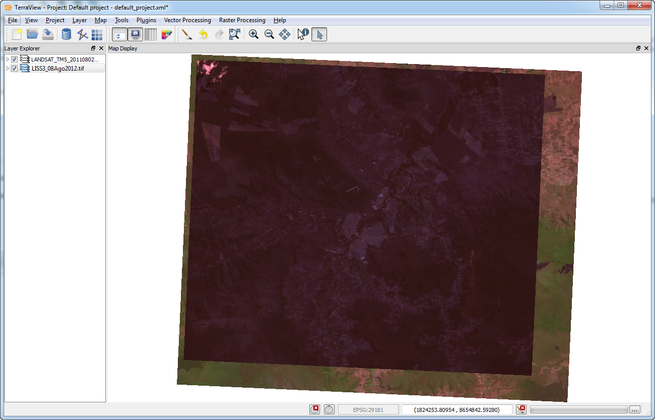
Below
is an
example of using the registry interface, exploring the possible options.
Note that the color composite of the reference raster was
changed
to look something like to the adjustment raster.
- Example of manual
acquisition of tie points:
- Example of
automatic acquisition of tie points:
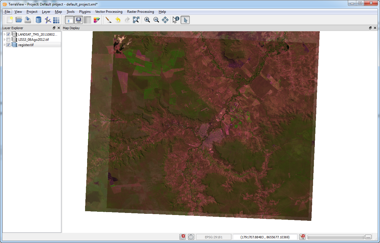
The
result
of this operation is shown in the figure below.