A Spatial Reference System, also known as a Coordinate System. More...
#include <SpatialReferenceSystem.h>
Public Member Functions | |
| const std::string & | getName () const |
| Returns the SRS name. More... | |
| void | getSRID (int &id, std::string &authName) const |
| Returns SRS integer identification. More... | |
| const std::string & | getUnitName () const |
| Returns the SRS unit name. More... | |
| virtual std::string | getWKT () const =0 |
| Returns an OGC's WKT representation for the SRS. More... | |
| virtual bool | isGeographic () const =0 |
| Returns true is a geographic coordinate system and false otherwise. More... | |
| void | setName (const std::string &name) |
| Sets the SRS name. More... | |
| void | setSRID (int id, const std::string &authName="EPSG") |
| Sets the SRS integer identification. More... | |
| void | setUnitName (const std::string &name) |
| Sets the SRS unit name. More... | |
| SpatialReferenceSystem (const std::string &name="", const std::string &unitName="") | |
| Default constructor. More... | |
| virtual | ~SpatialReferenceSystem () |
| Virtual destructor. More... | |
Protected Attributes | |
| std::string | m_name |
| std::pair< unsigned int, std::string > | m_srid |
| std::string | m_unitName |
Detailed Description
A Spatial Reference System, also known as a Coordinate System.
A spatial reference system (SRS) or coordinate reference system (CRS) is a coordinate-based local, regional or global system used to locate geographical entities.
Definition at line 49 of file SpatialReferenceSystem.h.
Constructor & Destructor Documentation
◆ SpatialReferenceSystem()
| te::srs::SpatialReferenceSystem::SpatialReferenceSystem | ( | const std::string & | name = "", |
| const std::string & | unitName = "" |
||
| ) |
Default constructor.
- Parameters
-
name The SRS name. Default empty string. unitName The SRS unit name. Default empty string;
◆ ~SpatialReferenceSystem()
|
virtual |
Virtual destructor.
Member Function Documentation
◆ getName()
| const std::string& te::srs::SpatialReferenceSystem::getName | ( | ) | const |
Returns the SRS name.
◆ getSRID()
| void te::srs::SpatialReferenceSystem::getSRID | ( | int & | id, |
| std::string & | authName | ||
| ) | const |
Returns SRS integer identification.
- Parameters
-
id To return the unique id (output); authName To return the authority responsible for the id (output).
◆ getUnitName()
| const std::string& te::srs::SpatialReferenceSystem::getUnitName | ( | ) | const |
Returns the SRS unit name.
◆ getWKT()
|
pure virtual |
Returns an OGC's WKT representation for the SRS.
The WKT definition based on document "OpenGIS Implementation Specification: Coordinate Transformation Services Revision 1.00 - pages 18 and 19.
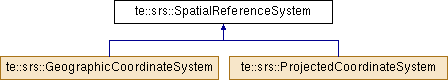
Implemented in te::srs::ProjectedCoordinateSystem, and te::srs::GeographicCoordinateSystem.
◆ isGeographic()
|
pure virtual |
Returns true is a geographic coordinate system and false otherwise.
Implemented in te::srs::ProjectedCoordinateSystem, and te::srs::GeographicCoordinateSystem.
◆ setName()
| void te::srs::SpatialReferenceSystem::setName | ( | const std::string & | name | ) |
Sets the SRS name.
- Parameters
-
name the SRS name.
◆ setSRID()
| void te::srs::SpatialReferenceSystem::setSRID | ( | int | id, |
| const std::string & | authName = "EPSG" |
||
| ) |
Sets the SRS integer identification.
Spatial reference systems can be referred to using a SRID integer, given by an authority, such as the EPSG codes defined by the International Association of Oil and Gas Producers.
- Parameters
-
id The SRS integer identifier. authName The authority responsible for the identifier. Default "EPSG".
◆ setUnitName()
| void te::srs::SpatialReferenceSystem::setUnitName | ( | const std::string & | name | ) |
Sets the SRS unit name.
- Parameters
-
name the SRS unit name.
Member Data Documentation
◆ m_name
|
protected |
Definition at line 112 of file SpatialReferenceSystem.h.
◆ m_srid
|
protected |
Definition at line 115 of file SpatialReferenceSystem.h.
◆ m_unitName
|
protected |
Definition at line 113 of file SpatialReferenceSystem.h.
The documentation for this class was generated from the following file:
- /home/castejon/castejon_files/develop/terralib5/git_release/src/terralib/srs/SpatialReferenceSystem.h
