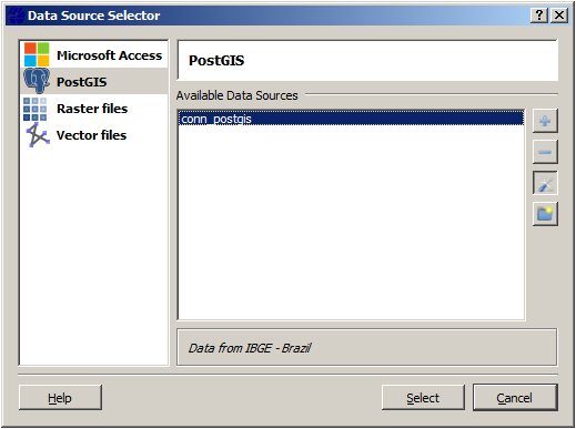
Each type of Data Source has a set of parameters defined in an appropriate interface. If at least one data source is defined (PostGIS at this example), click on Select to see all the datasets available. The dataset names will be showed and one or more datasets can be selected to be manipulated by the application.
It is
important to note that the
datasets still at the original
data source.
Also you can combine datasets from different sources, for example you
can
select a shape file from a directory and a spatial table from
PostGIS and draw
them without any import/export action over the original data.
Click on Select and a new interface will be provide with all datasets available.