|
|
|
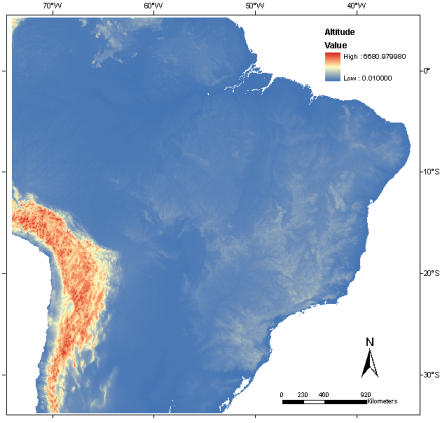
Altitude

Altitude data was obtained from SRTM( Shuttle Radar Topographic Mission), imagery, of 3 arc-seconds of horizontal (spatial) resolution and resampled to 30 arc-seconds (~1 km) of spatial resolution. The vertical resolution is of 1 m.
The altitude asc-grid file represents the data in meters.
Additional information about altitude and other SRTM derivative data, as well as altitude data at finer spatial resolution can be obtained at TOPODATA – Brazilian Geomorphometric Database (http://www.dsr.inpe.br/topodata/), as described by Valeriano (2008).
|
|