|
|
|
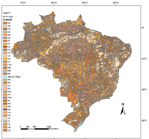
Soil Map

The soil map was provided by EMBRAPA (Brazilian Agricultural Research Corporation) mapping, which used the new Brazilian system of soil classification (EMBRAPA 1999) and was published by IBGE (2001).
From the original soil map (shapefile format), the CLASSE attribute was selected to generate the vegetation ASC-grid file.
The soil map reference is:
IBGE - EMBRAPA - Mapa de Solos do Brasil. Rio de Janeiro: IBGE, 2001 - Escala 1:5.000.000.
The original soil map (shapefile format) can be downloaded for Brazil limit.
|
|