|
|
|
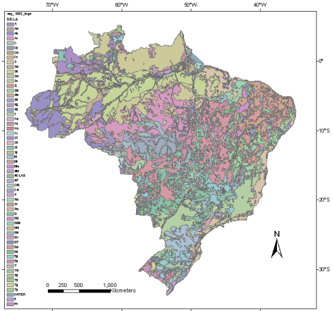
Vegetation Map

The Brazilian Vegetation Map depicts the vegetation cover of Brazilian territory from the original radar image-maps produced by RADAMBRASIL Project, at 1:250,000 scale, published by IBGE (1992).
he Vegetation Map for the Brazilian Legal Amazon was also originated from RADAMBRASIL data, but it has been updated by the Amazon Survaillance System Project (SIVAM) which published it in digital format, and 1: 250,000 original scale (SIVAM 2002).
The vegetation classification system of RADAMBRASIL reflects the classification key proposed by Veloso et al.(1991).
From the original vegetation map (shapefile format), the LEG_UVEG attribute was selected to generate the vegetation ASC-grid file.
The vegetation map reference is:
IBGE - EMBRAPA - Mapa de Solos do Brasil. Rio de Janeiro: IBGE, 2001 - Escala 1:5.000.000.
The original vegetation map (shapefile format) can be downloaded for Brazil or Brazilian Legal Amazon limits..
|
|