:: Gilberto Câmara ::
Welcome! Please visit my new homepage at https://gilbertocamara.org
Journal Papers
2015-2019
dtwSat: Time-Weighted Dynamic Time Warping for Satellite Image Time Series Analysis in R.
Victor Maus, Gilberto Camara, Edzer Pebesma, Marius Appel. Journal of Statistical Software, 88(5), 2019.
Spatiotemporal interval logic for reasoning about land use change dynamics.
Adeline Maciel, Gilberto Camara, Lubia Vinhas, Michelle Picoli, Rodrigo Begotti, Luiz Assis. Inter. Journal of Geographical Information Science, 33(1):176-192, 2019.
Big Earth Observation Time Series Analysis for Monitoring Brazilian Agriculture.
Michelle Picoli, Gilberto Camara, Ieda Sanches, Rolf Simoes, Alexandre Carvalho, Adeline Maciel, Alexandre Coutinho, Julio Esquerdo, Joao Antunes, Rodrigo Begotti, Damien Arvor, Claudio Almeida. ISPRS Journal of Photogrammetry and Remote Sensing, 145 (Nov):328-339, 2018.
Future environmental and agricultural impacts of Brazil’s Forest Code.
Aline Soterroni, Aline Mosnier, Alexandre Carvalho, Gilberto Câmara, Michael Obersteiner, Pedro Andrade, Ricardo Souza, Rebecca Brock, Johannes Pirker, Florian Kraxner, Petr Havlik, Valerie Kapos, Erasmus zu Ermgassen, Hugo Valin, Fernando Ramos. Environmental Research Letters, 13 (074021), 2018.
Using Google Earth Engine to detect land cover change: Singapore as a use case.
Nanki Sidhu, Edzer Pebesma, Gilberto Câmara. European Journal of Remote Sensing, 51:1, 486-500, 2018.
SimiVal, a multi-criteria map comparison tool for land-change model projections.
A. Bradley, I. Rosa, R.Pontius Jr., S. Ahmed, M. Araújo, D. Brown, A. Brandão. G. Camara, T.Carneiro, A. Hartley, M. Smith, R. Ewers. Environmental Modelling & Software, vol.82:229-240, 2016.
A Time-Weighted Dynamic Time Warping Method for Land-Use and Land-Cover Mapping.
V. Maus, G. Câmara, R. Cartaxo, A. Sanchez, F. Ramos, G. Queiroz. IEEE Journal of Selected Topics in Applied Earth Observations and Remote Sensing, vol. 9(8):3729-3739, 2016.
2011-2015
Experiences with a Socio-Environmental Modeling Course.
P. Andrade, G. Câmara, R. Marreto, M. Monteiro, T. Carneiro, Flávia Feitosa. Modelling in Science Education and Learning, vol. 8(1):71-92, 2015.
An algebra for spatiotemporal data: from observations to events.
K. Ferreira, G. Camara, M. Monteiro. Transactions in GIS, 18(2):253–269,2014.
An extensible toolbox for modelling nature-society interactions.
T. Carneiro, P. Andrade, G. Câmara, M. Monteiro, Rodrigo Pereira. Enviromental Modelling and Software, 46:104-117, 2013.
GeoDMA—Geographic Data Mining Analyst.
T. Körting, L. Fonseca, G. Câmara. Computers & Geosciences, 57:133–145, 2013.
Agricultural land use dynamics in the Brazilian Amazon based on remote sensing and census data.
G. Espindola, A. Aguiar, E. Pebesma, G. Camara, L. Fonseca. Applied Geography, 32(2):240-252, 2012.
Using Fuzzy Cognitive Maps to describe current system dynamics and develop land cover scenarios: a case study in the Brazilian Amazon.
L. Soler, K. Kok, G. Camara, A. Veldkamp. Journal of Land Use Science, 7(2):149-175, 2012.
2006-2010
Transfer function noise modeling and spatial interpolation to evaluate risks of extreme shallow water table depths in the Brazilian cerrados.
Rodrigo Manzione, Martin Knotters, Gerard Heuvelink, Jos Von Asmuth, G. Camara. Hydrogeology Journal, 18(8):1927-1937, 2010.
Making species distribution models available on the Web for reuse in biodiversity experiments: Euterpe edulis species case study.
K. Fook, A. Monteiro, S. Amaral, G. Câmara, A. Ximenes, L. Arasato. Sociedade e Natureza, 21(1):39-49, 2010.
Predictive Risk Mapping of Water Table Depths in a Brazilian Cerrado Area.
R. Manzione, M.Knotters, G. Heuvelink, J. Asmuth, G. Camara. In: Alfred Stein, Wenzhong Shi, Wietske Nijker (ed), Quality Aspects in Spatial Data Mining, pp 73-89, Boca Raton, CRC Press, 2009.
Games on Cellular Spaces: How Mobility Affects Equilibrium.
P. Andrade, M. Monteiro, G. Camara, Sandra Sandri. Journal of Artificial Societies and Social Simulation, 12(1), 2009.
Long-term potential for tropical-forest degradation due to deforestation and fires in the Brazilian Amazon.
M. Cardoso, C. Nobre, G. Sampaio, M. Hirota, D. Valeriano, G. Camara. Biologia, 64(3): 433-437, 2009.
Suppressing temporal data in sensor networks using a scheme robust to aberrant readings.
I. Reis, G. Camara, R. Assuncao, M. Monteiro. International Journal of Distributed Sensor Networks, 5(6):771-805, 2009.
Dynamical coupling of multiscale land change models.
E. Moreira, S. Costa, A. Aguiar, G. Camara, T. Carneiro. Landscape Ecology, 24(9):1183-1194, 2009.
Yet Another Map Algebra.
J. Cordeiro, G. Camara, U. Freitas, F. Almeida. Geoinformatica, 13(2):183-202, 2009.
Geo-Ontologies.
F.Fonseca, G. Camara. Marguerite Madden (ed.), Manual of Geographic Information Systems, Bethesda, MD, ASPRS Press, 2009.
Spatial data infrastructures for the Amazon: a first step towards a global forest information system.
F. Fonseca, C. Davis Jr., G. Camara. Earth Science Informatics, 2(4), 2009.
Beyond SDI: Integrating Science and Communities to Create Environmental Policies for the Sustainability of the Amazon.
C. Davis Jr., F. Fonseca, G. Camara. Int Journal of Spatial Data Infrastructures Research, 4:156-174, 2009.
Geoweb services for sharing modelling results in biodiversity networks.
K. Fook, M. Monteiro, G. Camara, M. Casanova, S. Amaral. Transactions in GIS, 13(4):379-399, 2009.
Geographical Information Engineering in the 21st Century.
G. Camara, L. Vinhas, C.Davis, F.Fonseca, T. Carneiro. In: Gerhard Navratil (ed.) Research Trends in Geographic Information Science, pp.203-214, Berlin, Springer Verlag, 2009.
Understanding Global Change: The Role of Geographic Information Science in the Integration of People and Nature.
C. Davis, F. Fonseca, G. Camara. In: T. Nyerges, H.Couclelis, R. McMaster (eds.), The SAGE Handbook of GIS and Society, Thousand Oaks, CA, SAGE Publications 2009.
Image Mining: Detecting Deforestation Patterns Through Satellites.
M. Silva, G. Camara, I. Escada. In: H. Rahman (ed.),Data Mining Applications for Empowering Knowledge Societies, New York, IGI Publishing, 2008.
Remote Sensing Image Mining: Detecting Agents of Land Use Change in Tropical Forest Areas.
M. Silva, G. Camara, I. Escada, R. Souza. International Journal of Remote Sensing, 29(16): 4803-4822, 2008.
Next-Generation Digital Earth.
M. Craglia, M. Goodchild, A. Annoni, G. Camara, M.Gould, W. Kuhn, D. Mark, I. Masser, D. Maguire, S. Liang, E. Parsons. International Journal of Spatial Data Infrastructures Research, 3:146-167, 2008.
TerraLib: An open-source GIS library for large-scale environmental and socio-economic applications.
G. Camara, L. Vinhas, G. Queiroz, K. Ferreira, M. Monteiro, M. Carvalho, M. Casanova. In: B. Hall, M. Leahy (ed.), Open Source Approaches to Spatial Data Handling, Berlin, Springer, 2008.
Spatial statistical analysis of land-use determinants in the Brazilian Amazon: exploring intra-regional heterogeneity.
A. Aguiar, G. Camara, I. Escada. Ecological Modelling, 209(1-2):169-188, 2007.
Global and Local Spatial Indices of Urban Segregation.
F. Feitosa, G. Camara, M. Monteiro, T. Koschitzki, M. Silva. International Journal of Geographical Information Science, 21(3):299-323, 2007.
Information Policies and Open Source Software in Developing Countries.
G. Camara, F. Fonseca. Journal of the American Society for Information Science and Technology (JASIST), 58(1):121-132, 2007.
Efficient regionalisation techniques for socio-economic geographical units using minimum spanning trees.
R. Assuncao, M. Neves, G. Camara, C. Freitas. International Journal of Geographical Information Science, 20(7):797-812,2006.
DMSP/OLS Night-Time Lights Imagery And Urban Population Estimates in the Brazilian Amazon.
S. Amaral, M. Monteiro, G. Camara, J. Quintanilha. International Journal of Remote Sensing, 27(5):855-870, 2006.
Networks of Innovation and the Establishment of a Spatial Data Infrastructure in Brazil.
G. Camara, F. Fonseca, M. Monteiro, H. Onsrud. Information Technology for Development, 12(4):255-272, 2006.
Parameter Selection for Region-Growing Image Segmentation Algorithms using Spatial Autocorrelation.
G. Espindola, G. Camara, I. Reis, L. Bins, M. Monteiro. International Journal of Remote Sensing, 27(14/20):3035-3040, 2006.
A Framework for Measuring the Interoperability of Geo-Ontologies.
F.Fonseca, G. Camara, M. Monteiro. Spatial Cognition and Computation, 6(4):307-329, 2006.
2001-2005
Nighttime lights - DMSP Satellite Data as an Indicator of Human Activity in the Brazilian Amazonia: relations with population and electrical power consumption.
S.Amaral, G. Camara, M. Monteiro, Chris Elvidge, J. Quintanilha. Computers, Environment and Urban Systems, 29:179-195, 2005.
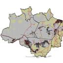
Amazon Deforestation Models.
G. Camara, A. Aguiar, I. Escada, S. Amaral, T. Carneiro, M. Monteiro, R. Araujo, Ima Vieira, Bertha Becker. Science, 307(15 February 2005):1043-1044, 2005.
GIS and Remote Sensing As Tools For The Simulation Of Urban Land Use Change.
C. Almeida, M. Monteiro, G. Camara, B. Soares-Filho, G. Cerqueira, C.Pennachin, M. Batty. International Journal Of Remote Sensing, 26(4):759-774, 2005.
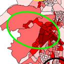
Mapping Social Exclusion/Inclusion in Developing Countries: Social Dynamics of Sao Paulo in the 90's.
G. Camara, M. Monteiro, F. Ramos, A. Sposati, D. Koga. In: D. Jonelle, M. Goodchild (eds.), Spatially-Enabled Social Science: Examples in Best Practice, New York, Oxford University Press, 2004, pp 223-237.
Open Source GIS Software: Myths and Realities.
G. Camara, H. Onsrud. In: J. Esanu and P. Uhlir (eds), Open Access and the Public Domain in Digital Data and Information for Science, Washington, The National Academies Press, 2004.
Stochastic cellular automata modeling of urban land use dynamics: empirical development and estimation.
C. Almeida, M. Batty, M. Monteiro, G. Camara, B.Soares, G. Cerqueira, C. Penachin. Computers, Environment and Urban Systems, 27(5):481-509, 2003.
Evaluation of the Performance of Fuzzy Logic Applied in Spatial Analysis for Mineral Prospecting.
F. Moreira, R. Almeida-Filho, G. Camara. Revista Brasileira de Geociencias, 33:183-190, 2003.
Bridging Ontologies and Conceptual Schemas in Geographic Information Integration.
F. Fonseca, C. Davis, G. Camara. GeoInformatica, 7(4):355-378, 2003.
Tabu Search Heuristic for Point-Feature Cartographic Label Placement.
M. Yamamoto, G. Camara, L. Lorena. GeoInformatica, 6(1):77-89, 2002.
Semantic Granularity in Ontology-Driven Geographic Information Systems.
F. Fonseca, M. Egenhofer, C. Davis, G. Camara. Annals of Mathematics and Artificial Intelligence, 36(1-2):131-151, 2002.
Using Ontologies for Integrated GIS.
F.Fonseca, M. Egenhofer, P. Agouris, G. Camara. Transactions on GIS, 6(3):231-257, 2002.
Geocomputation Techniques for Spatial Analysis: Is it the Case for Health data Sets?.
G. Camara, M. Monteiro. Reports on Public Health (Cadernos de Saude Publica), 17(5):1059-1081, 2001.
1996-2000
Towards a unified framework for spatial data models.
G. Camara, M. Monteiro, J. Paiva, J. Gomes, L. Velho. Journal of the Brazilian Computing Society, 7(1):17-25, 2000.
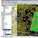
SPRING: Integrating Remote Sensing and GIS with Object-Oriented Data Modelling.
G. Camara, R. Souza, U. Freitas, J. Garrido, F. Ii. Computers and Graphics, 15(6):13-22, 1996.
Highlights
Land Use Change and Big EO Data
Spatial Analysis

Geospatial Ontology